Sites & Projects

Archaeological Sites
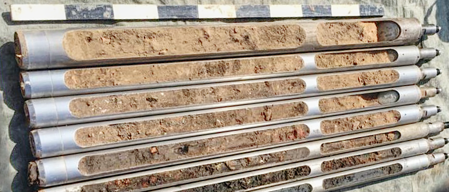
Bubastis was founded on a so-called gezira (Arabic: "island"). Gezira are the highest elevations of the Pleistocene delta surface, which surpassed later Holocene alluvial sands and were the preferred locations for settlements in the past. The gezira on which Bubastis was built had multiple local elevations with small water channels running between them. The natural topography divided the area into functional settlement zones, as temples, cemeteries and residential districts were frequently built at different levels. These elevations are known as kom (Arabic: "settlement mound"), of which Bubastis has at least three: the Central Kom, the central plateau of the gezira transitioning into a long slope to the east, the Northern Kom and the Western Kom. (Pub. no. 31)
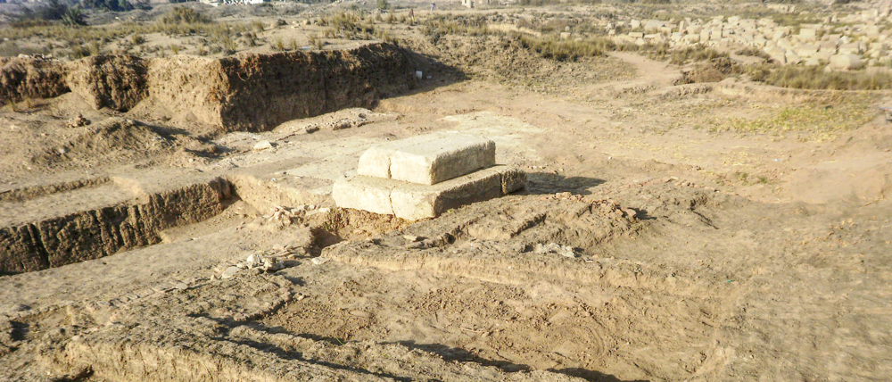
The settlement activity in Bubastis originated on the Western Kom, with Early Dynastic cemeteries. During the Old Kingdom, the Western Kom remained the centre of the settlement, when a governor's palace was built there in the 4th Dynasty (2670–2500 BCE) followed by two temples for the worship of the royal Ka of the rulers Teti and Pepi I in the 6th Dynasty (2350–2198 BCE). (Pub. no. 3, 5, 11, 23, 26) At this time the Western Kom functioned as an administrative and temple zone, while a funerary zone developed on the Northern Kom with several cemeteries dating from the 5th Dynasty to the beginning of the First Intermediate Period. (Pub. no. 1)
In the Middle Kingdom, a large palace for the governors of Bubastis was built on the northern part of the Northern Kom, along with an associated cemetery situated directly to the east of the palace. This palace may have been used as a temporary residence when the king stayed in Bubastis, for instance, to participate in festivities in honour of Bastet. After this the Northern Kom was used as a cemetery area once more. (Pub. no. 2, 6, 12, 16, 21)
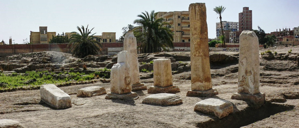
The temple of Bastet was built on the central Kom, in the centre of the highest plateau of the Gezira. The earliest incarnation of this temple was probably built on this spot as early as the Old Kingdom, but was subsequently extended over millennia. Nowadays, the visible remains on the surface date to the Third Intermediate Period (1069–664 BCE) and the Late Period (664–332 BCE), when Bubastis became one of the most important cities in Egypt. (Publ. no. 4, 7, 8, 9, 17, 18, 19) The texts and images from the 6th Dynasty to the end of the New Kingdom prove the earlier existence of the city. (Publ. No. 1, 5, 23) The sacred canals (Isheru) surrounding the temple were a characteristic feature of the temple, on which Bastet appeared in the form of her cult statue in her sacred barque during the festivals celebrated in her honour. (Publ. no. 14, 18, 20, 24, 27, 28)
What is left of the residential portion of the city lies on the large southeastern part of the tell, with visible structures on the surface from the Ptolemaic and Roman Periods (306 BCE to 4th century AD). The Histories of the Greek historian Herodotus (about 450 BCE) reveal that the town centre of Bubastis had been located there since the Late Period. At that time, a paved processional road, the so-called “Dromos”, connected the temple of Bastet in the west with another sacred building in the east, which Herodotus described as the "Temple of Hermes". The Dromos itself was also the main axis of the city. (Publ. no. 10, 20, 22)
Project: Temple Dromos & City Center
Project: Temple & Residence in the Old Kingdom
Project: Geoarchaeology & Landscape Reconstruction